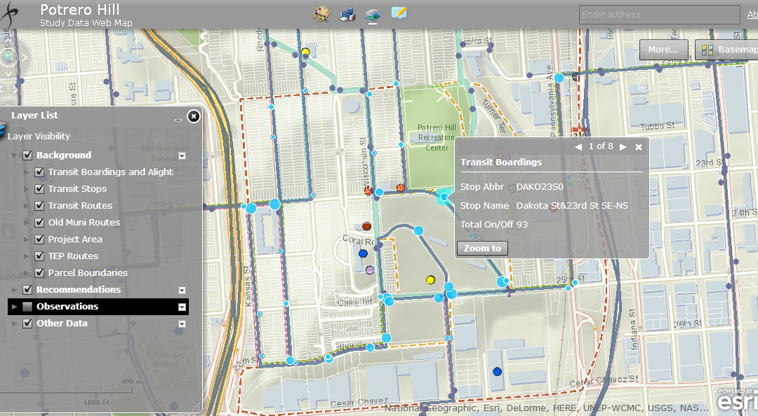
San Francisco County Transportation Authority’s Potrero Hill Webmap We developed an interactive webmap for SFCTA’s Potrero Hill project to show project-related data and provide editing tools so that users can add easily understand the environment, and data to the map...
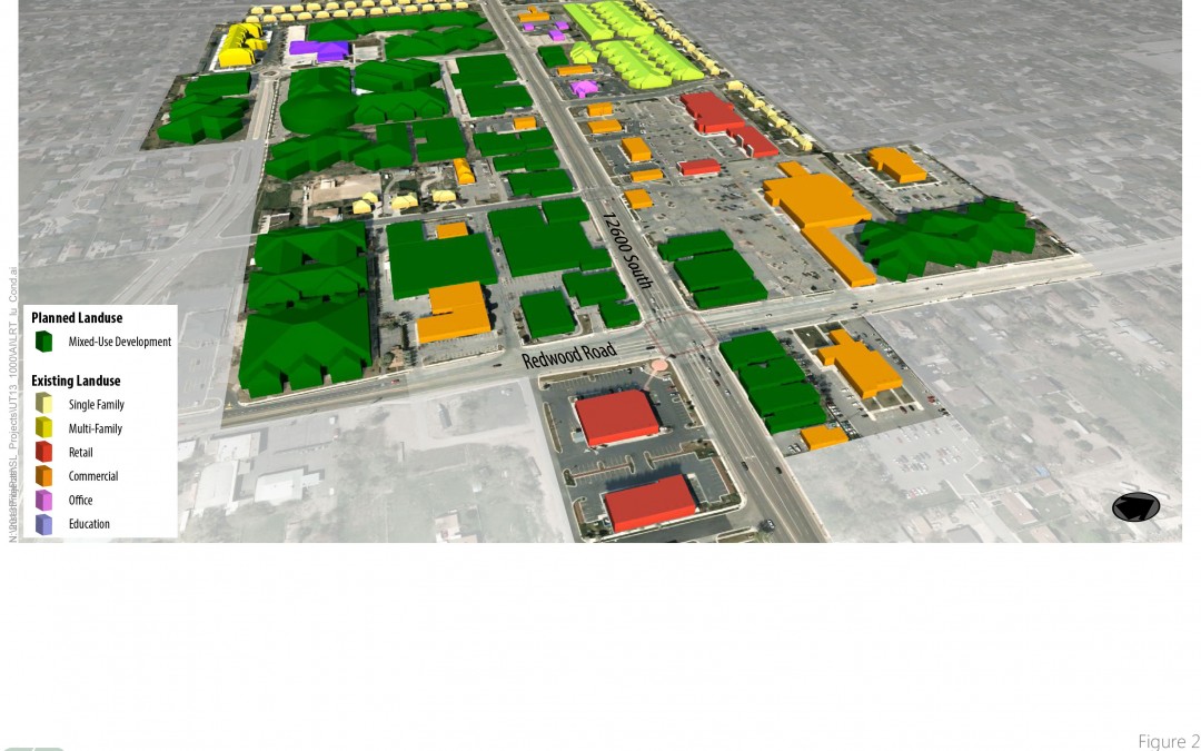
Utah Transit Authority Light Rail Station FeasibilityWe helped UTA analyze and visualize strategies for increased land use, to support the development of a new light rail facility. 3D maps provided a sense of reality and illustrated building heights in ways that 2D...
Westside Mobility PlanThis study considers multimodal travel, north-south rail connections, and parking solutions; also updating the Coastal Transportation Corridor Specific Plan and West LA Transportation Specific Plan, both of which include nexus fee updates, and...